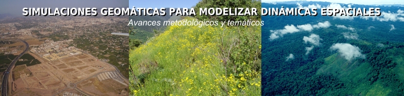
Paegelow M, Camacho Olmedo MT (coord.), 2008, Modelling Environmental Dynamics. Advances in geomatic solutions. Springer, series: Environmental Science and Engineering, 390 p. web
International Journal of Geographical Information Science.
©2012 Thomson Reuters, 2012 Journal Citation Reports®
http://www.tandf.co.uk/journals/journal.asp?issn=1365-8816&linktype=cfp
Special Issue on Land Change Modelling: moving beyond projections.
Paegelow M, Camacho Olmedo MT, Mas JF, Houet T and Pontius RG Jr. (2013) Land Change Modelling: moving beyond projections. International Journal of Geographical Information Science, vol. 27 (9), 1691-1695. Published By: Taylor & Francis. http://dx.doi.org/10.1080/13658816.2013.819104
Mas JF, Kolb M, Paegelow M, Camacho Olmedo MT and Houet T (2014) Inductive pattern-based land use / cover change models: A comparison of four software packages. Environmental Modelling & Software, 51(2014), 94-111. Publisher By: Elsevier. http://dx.doi.org/10.1016/j.envsoft.2013.09.010
Camacho Olmedo MT, Paegelow M and Mas JF (2013) Interest in intermediate soft-classified maps in land change model validation: suitability versus transition potential. International Journal of Geographical Information Science, 27 (12), 2343-2361. Published By: Taylor & Francis. http://dx.doi.org/10.1080/13658816.2013.831867.
Kolb, M., Mas, J.F. y Galicia L. (2013) Evaluating drivers of land-use change and transition potential models in a complex lanscape in Southern Mexico. International Journal of Geografphical Information Science 27(9): 1804-1827. DOI: 10.1080/13658816.2013.770517
Maestripieri N. et Paegelow M. (2013) Validation spatiale de deux modèles de simulation : l’exemple des plantations industrielles au Chili, Cybergéo - European Journal of Geography, 23 p. article 623, 12 septembre. http://cybergeo.revues.org/26042
Pérez-Vega A, Mas JF and Ligmann-Zielinska A (2012) Comparing two approaches to land use/cover change modeling and their implications for the assessment of biodiversity loss in a deciduous tropical forest. Env Modeling & sotware. Volume 29, Issue 1, March 2012, Pages 11-23. doi:10.1016/j.envsoft.2011.09.011. web
Paegelow M., Maestripieri N., Saez Vilalobus N., Toro Balbontin D. (2012) La détection des plantations forestières par imagerie MODIS : possibilités et limites. L’exemple de la cordillère littorale dans le sud-chilien continental, Mappemonde, 20p vol 106 (2012.2) http://mappemonde.mgm.fr/num24/articles/art12204.htm
Kolb M y Galicia L (2011) Challenging the linear forestation narrative in the Neo-tropic: regional patterns and processes of deforestation and regeneration in southern Mexico. doi: 10.1111/j.1475-4959.2011.00431.x The Geographical Journal, Royal Geographical Society. Wiley. web.
Mas JF y Flamenco Sandoval A (2011) Modelación de los cambios de coberturas / uso del suelo en una región tropical de México. Geotropico, 5(1), Artículo 1: 1-24. web
Mas JF, Kolb M, Houet T, Paegelow M, Camacho Olmedo MT (2011) Eclairer le choix de modèles de simulation des changements des modes d’occupation et d’usages des sols. Une approche comparative. Revue Internationale de Géomatique, Volume 21- N° 3/2011, pp 405-430. Revue Internationale de Géomatique, Hermes, Lavoisier, Francia. PDF
Mas JF, Kolb M, Houet T, Paegelow M, Camacho Olmedo MT (2011) Una comparación de diferentes enfoques de modelación de cambios de cobertura / usos del suelo. Revista SELPER, vol. 31 (1), 5-12. Sociedad de Especialistas Latinoamericanos en Percepción Remota y Sistemas de Información Espacial. Chile. ISSN 0717-2915. http://www.selper.org/revista.php
Paegelow M y Camacho Olmedo MT (2010) Modelos de simulación espacio-temporal y Teledetección: el método de la segmentación para la cartografía cronológica de usos del suelo. Serie Geográfica (Revista de la Universidad de Alcalá de Henares), Nº 16 (2010) “La Teledetección en la investigación geográfica”, pp. 19-34. ISSN 1136-5277. web
Houet T., Verburg P. and Loveland T. (2010) Monitoring and modelling landscape dynamics, Landscape Ecology, Vol 25, n°2, pp.163-167, http://dx.doi.org/10.1007/s10980-009-9417-x
Houet T., Loveland T. R., Hubert-Moy L., Napton D., Gaucherel C. and Barnes C. (2010) Exploring subtle land use and land cover changes: a framework based on future landscape studies, Landscape Ecology, Vol 25, n°2, pp.249-266 http://dx.doi.org/10.1007/s10980-009-9362-8
Barredo, JI, Engelen, G (2010) Land use scenario modelling for flood risk mitigation. Sustainability, 2, 1327-1344. PDF
Houet T, Hubert-Moy L et Tyssot C, (2008) «Modélisation prospective spatialisée à l’échelle locale: approche méthodologique», Revue Internationale de Géomatique, Vol. 18/3, pp. 345-373. web
Aguejdad R et Houet T (2008) “Modeling of urban sprawl using the Land Change Modeler on a French metropolitan area (Rennes): foresee the unpredictable”, International Symposium “Spatial landscape Modelling: from dynamic approaches to functionals evaluations”, Toulouse, 3-5 june 2008, France. PDF
Barredo, JI and Gómez Delgado, M (2008) Towards a set of IPCC SRES urban land-use scenarios: Modelling urban land-use in the Madrid region. In: M Paegelow and MT Camacho Olmedo (Eds.), Modelling Environmental Dynamics, Springer, pp. 363-385. web
Camacho Olmedo MT, Paegelow M, García Martínez P (2008): Retrospective geomatic landscape modeling. A probabilistic approach. En: Paegelow, M and Camacho Olmedo MT (Eds.), Modelling environmental dynamics. Advances in Geomatic simulations. Pp. 247-268. Series Environmental Science. Springer Verlag. Heidelberg. web
Camacho Olmedo MT, Molero Melgarejo E y Paegelow M (2010) Modelos geomáticos aplicados a la simulación de cambios de usos del suelo. Evaluación del potencial de cambio. En: Ojeda J, Pita MF y Vallejo I (Eds.): Tecnologías de la Información Geográfica: La información geográfica al servicio de los ciudadadanos. Secretariado de Publicaciones de la Universidad de Sevilla. Sevilla. Pp. 658-678. ISBN: 978-84-472-1294-1. PDF texto / Poster
Cuevas G et Mas JF (2008) Land use scenarios: a communication tool with local communities, in Modelling Environmental Dynamics, Paegelow M & Camacho Olmedo MT (Eds.), Ed Springer, pp. 223-246. web
Feyen, L, Barredo, JI, Dankers, R (2009) Implications of global warming and urban land use change on Flooding in Europe. In: J Feyen, K Shannon and M Neville (Eds.) Water & Urban Development Paradigms - Towards an integration of engineering, design and management approaches. CRC Press, London, pp. 217-225. PDF
Kolb, M (2010) Land use and cover change in southern Mexico: evidence for Changing trends in a highly dynamic landscape. In: Azevedo JC, Feliciano M, Castro J and Pinto MA (eds.) Forest Landscapes and Global Change-New Frontiers in Management, Conservation and Restoration. Abstracts of the IUFRO Landscape Ecology Working Group International Conference, September 21-27, 2010, Bragança, Portugal Pp 167. PDF
Mas JF and Flamenco Sandoval A (2011) Modelagem das mudanças de uso do solo e cobertura vegetal numa regiao tropical do México. GeoNordeste (Simpósio Regional de Geoprocessamento e Sensoriamento Remoto Geonordeste) III Seminário de Geotecnologia. 06 a 10 de novembro de 2011, Feira de Santana, Brasil. PDF
Mas JF, Kolb M, Houet T, Paegelow M, Camacho Olmedo MT (2010) Una comparación de diferentes enfoques de modelación de cambios de cobertura / uso delsuelo, Memorias del XIV Simposio Internacional SELPER 2010, Guanajuato, Gto, 8-12 Nov. 2010 (CD). ISBN 978-607-441-100-3. PDF
Mas JF, Kolb M, Houet T, Paegelow M, Camacho Olmedo MT (2011) Una comparación de diferentes enfoques de modelación de cambios de cobertura / uso del suelo. Anais do XV SBSR Simposio Brasileiro de Sensoramiento Remoto. Curitiba, 30 abril-5 mayo 2011, Brasil. Instituto Nacional de Pesquisas Espaciais (INPE). Pp. 5801-5808. ISBN 978-85-17-00057-7. PDF
Mas JF, Pérez-Vega A and Clarke K (2010) Assessing simulated land use/cover maps using similarity and fragmentation indices. ASPRS Annual Conference, April 26–30 2010, San Diego, CA, USA. PDF
Mas JF, Pérez Vega A and Clarke K (2010) Assessing “spatially explicit” land use/cover change models. In: Azevedo JC, Feliciano M, Castro J and Pinto MA (eds.) Forest Landscapes and Global Change-New Frontiers in Management. Conservarion and Restoration. Proceedings of the IUFRO Landscape Ecology Working Group International Conference, September 21-27, 2010, Bragança, Portugal Pp 508-513. PDF
Mas JF, Pérez Vega A, Clarke K y Sánchez-Cordero V (2010) Modeling land use/cover change and biodiversity conservation in México. In: Azevedo JC, Feliciano M, Castro J and Pinto MA (eds.) Forest Landscapes and Global Change-New Frontiers in Management. Conservarion and Restoration. Proceedings of the IUFRO Landscape Ecology Working Group International Conference, September 21-27, 2010, Bragança, Portugal Pp 262-267. PDF
Molero Melgarejo E y García Martínez P (2010) Gradientes de accesibilidad y transformación territorial: Una aportación a los estudios de fragilidad paisajística. VI CIOT Congreso Internacional de Ordenación del Territorio, Octubre 2010, Pamplona. ISBN: 978-84-693-72739. Pp. 1382-97. PDF
Paegelow M and Camacho Olmedo MT (2008): Advances in geomatic simulations for environmental dynamics. En: Paegelow M and Camacho Olmedo MT (coord): Modelling environmental dynamics. Advances in Geomatic simulations. Pp. 3-56. Series Environmental Science. Springer Verlag. Heidelberg. web
Paegelow M, Camacho Olmedo MT, Ferraty F, Ferré F, Sarda P, Villa N (2008): Prospective modelling of environmental dynamics. A methodological comparison applied to mountain land cover changes. En: Paegelow M and Camacho Olmedo MT (coord): Modelling environmental dynamics. Advances in Geomatic simulations. Pp. 141-168 Series Environmental Science. Springer Verlag. Heidelberg. web
Conférence internationale de Géomatique et Analyse Spatiale SAGEO’10 (Spatial Analysis and GEOmatics 2010) «Outils, Méthodes et Modèles en Géomatique pour la production de connaissances sur les territoires et le paysage» Groupe de recherche européen S4 (Spatial Simulation for the Social Sciences). Universidad de Toulouse Le Mirail, Toulouse, Francia. Comité organizador M. Paegelow. Comité científico (miembros del proyecto). web
XIX Reunión Nacional SELPER - México, Centro de Investigaciones en Geografía Ambiental, de la UNAM. Morelia, del 3 al 7 de octubre de 2011. Comité organizador JF Mas. Comité científico (miembros del proyecto). web
III Coloquio Internacional en Geografía Ambiental, Evaluación del territorio para objetivos y escalas múltiples (Land evaluation for multiple objectives and scales). México, UNAM, Morelia, del 22 al 24 de marzo de 2012. Comité organizador JF Mas. Comité científico (miembros del proyecto). web
2010-2014: Programme ANR «Jeune Chercheur». Projet: «Modélisation rétrospective et prospective des changements d'usages des sols dans les Pyrénées" (MODE RESPYR) – Direction: T. Houet (GEODE UMR 5602 CNRS)
2005-2009: ECOS-Nord Mexique n° M05AH4. Projet intitulé: Modélisations prospectives de l’occupation du sol par approches géomatique et statistique. Direction: Paegelow M. (France), Jean-François Mas (Mexique). Partenariat: GEODE UMR 5602 CNRS, Institut de Géographie Université Nationale Autonome du Mexique (UNAM).
2011-2013. Elaboración y Aplicación de modelos prospectivos de cambio de cobertura/uso del suelo. Programa de Apoyo a Proyectos de Investigación e Innovación Tecnológica (PAPIIT). Universidad Nacional Autónoma de México. PAPIIT 2011.Dirección Jean-François Mas, Centro de Investigaciones en Geografía Ambiental de la UNAM.
![]()
![]()
![]()
![]()
![]()
![]()
![]()
![]()
![]()
![]()
Proyecto financiado por: