|
Welcome to the site of International Geoscience
Program Project |
About the IGCP. "The IGCP is a cooperative enterprise of UNESCO and the International Union of Geological Sciences (IUGS) and has been stimulating comparative studies in the Earth Sciences since 1972. After three decades of successful work, the "International Geological Correlation Programme" continued, as "International Geoscience Programme". IGCP has made research results available to a huge number of scientists around the world"
We acknowledge the financial support from IUGS and UNESCO
|
The "International Geoscience Program" defined “The Deep Earth” among five areas of special interest in 2007’s call for proposals. Antonio García-Casco (University of Granada) and Uwe Martens (Stanford University) submitted the proposal “Subudction Zones of the Caribbean”, a project aiming to continue efforts from previous IGCP projects to unravel the complex geologic evolution of the Caribbean area, but focusing particularly on deep earth processes and materials, from both ancient suture zones and active convergent margins. The proposal was awarded support as IGCP project 546 for the years 2007-2011. Colleagues from a number of countries and institutions worldwide enthusiastically gave support to the project. Click on people to get the list, and send us a mail if you are interested in joining us and/or receiving information. |
|
|
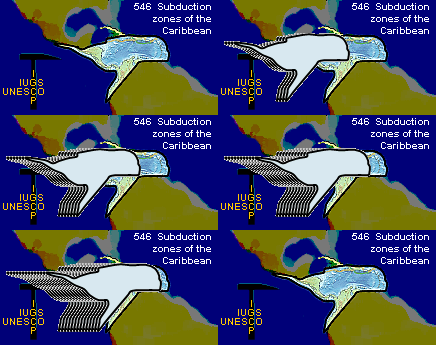
It represents the Caribbean Plate as a "whale" facing the East. Subduction allows it to swim across the inter-America gap. Hopefully, it will freely swim in the Atlantic in the future. |
|
|
Our project also endorses the program “Earth Sciences for Society - an International Year of Planet Earth”. Earth's systems greatly impinge on our daily lives, and interpreting both the history of the Earth and use that knowledge as a basis for forecasting likely future events is a matter of global concern. Therefore, one of IGCP 546 main goals is to establishing links between ancient and current subduction zones of the Caribbean, inasmuch as this is critical for a well founded understanding of the tectonic evolution of the associated convergent plate-margins, which will hopefully enable a better understanding of the geodynamics of such a populated and geologically hazardous region. The project has a duration of 5 years (2007-2011). Our cooperative plan is to organize a series of workshops and field trips throughout the Caribbean that will enable a systematic comparison of high-pressure belts and help unravel the history of subduction in the region. See our targets in Activities.
NEW: Greater Antilles Map – a GIS database for the Dominican Republic, Haiti, Cuba, Jamaica, Puerto Rico and the Virgin Islands by Carl Nelson. Recursos del Caribe, S.A.» Greater Antilles (download .jpg image; 7.5 MB) |
 About our IGCP 546 logo.